un
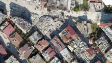
UN Mappers in support of Türkiye and Syria - Mapping for Emergency Relief
The United Nations Global Service Centre (UNGSC) is at the forefront of adopting state-of-the-art geospatial technology to address UN operational needs. UN Maps was established in 2019 to support the mandates of UN peacekeeping missions and Agencies, Funds and Programmes based on a suite of geospatial solutions and by leveraging both UN-managed and open data sources.
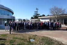
Second UN Maps Conference, 6 – 10 March 2023, Valencia, Spain
The Second United Nations Maps Conference took place at the United Nations Information and Communications Technology facility (UNICTF) in Valencia, Spain, between 6 and 10 March 2023. It brought together around 45 entities and external partners to strengthen coordination, collaboration and the capacity of geospatial information to meet global challenges.
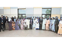
Workshop on Capacity Building for Geospatial Information Actors in Bamako, Mali - September 12-16, 2022
Following exchanges between the Geospatial Information Section of the United Nations and the Geographical Institute of Mali within the activities of the United Nations Committee of Experts on Global Geospatial Information Management (UN-GGIM), in Africa (UN-GGIM Africa) and of the Second Administrative Level Boundaries (SALB) programme, the offices agreed to organize a workshop for the development and capacity building for actors on geospatial information in Mali.