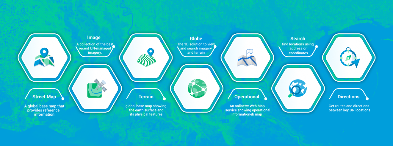
UN Maps offers a comprehensive suite of features tailored to meet the diverse needs of the United Nations and its partners. From detailed street-level mapping to high-resolution image visualization, UN Maps provides tools for navigation, data analysis, and decision-making.
Users can access route planning, search functionality, and operational tools to support mission-critical activities and humanitarian efforts. With an interactive globe view, UN Maps offers a unique perspective on global dynamics and interconnectedness.
Whether you're navigating urban environments or monitoring remote regions, UN Maps empowers users to explore, analyze, and address challenges on a global scale.
Map Features
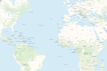
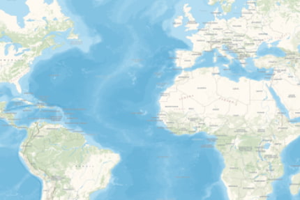
Street Map - Standard
With its versatile basemap options, UN Streetmap offers a tailored experience to suit every need and preference.
Choose from three distinct flavors—standard, light, and dark—each meticulously crafted to provide optimal visibility and clarity. Users can use these basemaps for custom maps or their own web applications and have access to accurate and up-to-date basemap data sourced from both open data and UN-specific sources.
With UN Streetmap, users can customize their mapping experience to suit their unique needs and preferences, empowering them to map with confidence and efficiency across diverse environments.
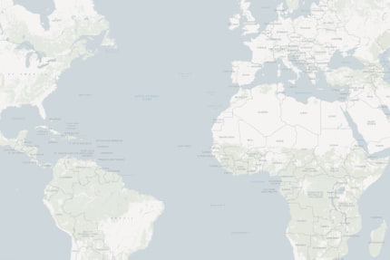
Street Map - Light
UN Image Map is a set of high-resolution satellite and drone imagery mosaiced together to offer users a captivating visual experience unlike any other. Immerse yourself in a collection of meticulously mosaiced imagery provided by UN actors, capturing the Earth's surface with unparalleled detail and precision.
From sprawling urban metropolises to remote wilderness areas, users can zoom in and discover intricate details with remarkable clarity.
Whether analyzing terrain, monitoring changes over time, or identifying key features, UN Image Map provides a powerful tool for gaining insights and understanding the world around us.
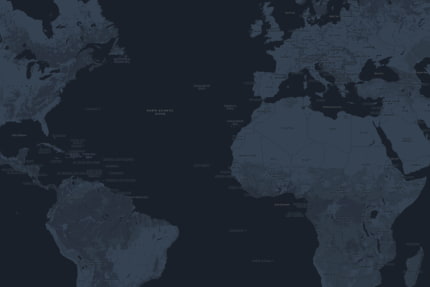
Street Map - Dark
With UN Globe, users can visualize geographic information in three dimensions, offering a dynamic and engaging perspective on the world around us.
UN Globe transforms traditional mapping data into a captivating 3D experience, allowing users to navigate through landscapes with depth and realism.
Whether analyzing topography, exploring urban environments, or understanding spatial relationships, UN Globe provides a powerful tool for gaining a deeper understanding of our planet. With its intuitive interface and interactive features, users can interact with data in new ways, unlocking new insights and possibilities.
Experience the world in 3D with UN Globe, where every contour, every elevation, and every feature comes to life in stunning detail.
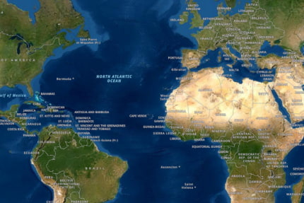
Image Map
UN Image Map is a set of high-resolution satellite and drone imagery mosaiced together to offer users a captivating visual experience unlike any other. Immerse yourself in a collection of meticulously mosaiced imagery provided by UN actors, capturing the Earth's surface with unparalleled detail and precision.
From sprawling urban metropolises to remote wilderness areas, users can zoom in and discover intricate details with remarkable clarity.
Whether analyzing terrain, monitoring changes over time, or identifying key features, UN Image Map provides a powerful tool for gaining insights and understanding the world around us.
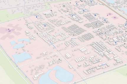
Terrain Map
UN Terrain Map offers a detailed representation of the Earth's surface, designed to highlight topographic features such as mountains, valleys, and plains.
With a focus on natural landscape elements, this basemap is ideal for users looking to create maps that emphasize elevation, landforms, and geographical features.
Whether you're building custom maps or integrating it into your own web applications, the Terrain Map provides accurate and up-to-date data, sourced from reliable open datasets and UN-specific resources. Its fine-tuned design ensures clarity and readability across a wide range of use cases, empowering users to map diverse terrains with precision and insight.
Globe
With UN Globe, users can visualize geographic information in three dimensions, offering a dynamic and engaging perspective on the world around us.
UN Globe transforms traditional mapping data into a captivating 3D experience, allowing users to navigate through landscapes with depth and realism.
Whether analyzing topography, exploring urban environments, or understanding spatial relationships, UN Globe provides a powerful tool for gaining a deeper understanding of our planet. With its intuitive interface and interactive features, users can interact with data in new ways, unlocking new insights and possibilities
Operational Features
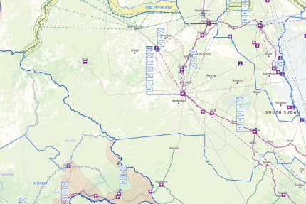
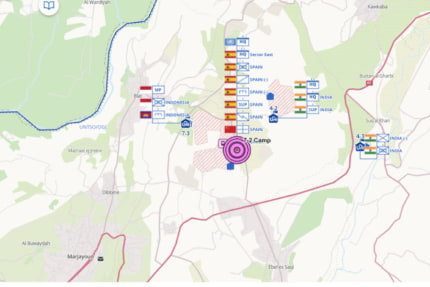
Operational Map
Designed to provide users with comprehensive insights into operational landscapes, UN Operational Map offers a dynamic visualization platform for a wide range of UN-specific data.
Explore security checkpoints, flight paths to missions, vulnerability areas, and military personnel locations with precision and clarity. With UN Operational Map, users can seamlessly navigate through complex operational environments, gaining valuable insights into spatial relationships, resource allocation, and situational awareness.
Whether coordinating emergency response efforts, managing supply chains, or monitoring security situations, UN Operational Map equips users with the tools and information needed to make informed decisions. By visualizing UN-sourced data in a clear and intuitive manner, this feature enhances operational efficiency, effectiveness, and safety across diverse missions and scenarios.
Search
Search is a versatile feature within UN Maps that revolutionizes the way users access relevant points of interest information. By harnessing the power of both open data and operational insights, Search offers a comprehensive tool for quickly finding critical information with ease.
Whether seeking specific addresses, landmarks, or geographic coordinates, Search provides intuitive access to a wealth of data sources. By tapping into open data repositories and leveraging mission-specific operational information, Search ensures users can locate points of interest relevant to their needs, whether they are humanitarian workers or military personnel.
From identifying key facilities to pinpointing strategic locations, Search empowers users to make informed decisions and take action with confidence.
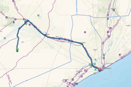
Directions
Direction is a powerful feature within UN Maps designed to streamline route planning and ensure safe navigation from point A to point B. By leveraging both open data and operational information, Direction offers users a comprehensive tool for efficient and secure travel.
Whether navigating through urban landscapes or traversing remote regions, Direction takes into account various factors such as road accessibility and safety considerations. With access to operational information, Direction prioritizes the safest supply routes, ensuring users reach their destinations with confidence.
By combining the latest open data with mission-critical operational insights, Direction empowers users to make informed decisions and navigate complex terrain with ease.