
On 24–25 August 2026, BCL (Biodiversity Conservation for Life) and UN Mappers held a two-day training workshop on collaborative mapping and open-source tools in Kribi, South Region of Cameroon. Delivered under the UN Maps Community Ambassadors Initiative, the workshop aimed to strengthen local capacity to produce open geospatial data in support of local development, biodiversity conservation and the humanitarian action of the United Nations.
The first day introduced UN Mappers and the OpenStreetMap ecosystem, guided the creation of contributor accounts and ran a mapathon. The second day focused on field mapping: collecting real data with ChatMap, then visualising and publishing it as interactive maps with uMap.
The workshop mobilised 37 participants on the first day and 27 on the second, enabled the creation of 22 OpenStreetMap accounts, the formation of 5 thematic groups and the publication of 5 interactive maps covering Kribi’s urban living environment. These outcomes lay the groundwork for a local mapping community and for the envisaged creation of a UN Mappers Chapter in Cameroon.
Results at a glance
2 training days | 37 / 27 participants (D1 / D2) | 22 OSM accounts created | 5 thematic groups | 5 maps published | 5 tools covered |
Context and objectives
Partnership framework
The workshop is part of the partnership between BCL and UN Mappers under the UN Maps Ambassadors Programme. This programme explores the deployment of open-mapping Chapters and Hubs, contributing to the humanitarian efforts of the United Nations through the production of open geospatial data. The Kribi area — a fast-growing coastline with a deep-water port and sensitive coastal ecosystems — has strong needs for better geospatial knowledge of its territory.
Workshop objectives
Introduce the UN Mappers initiative, its mandate and its missions in Cameroon;
Familiarise participants with the OpenStreetMap ecosystem and guide the creation of contributor accounts;
Train participants in field data collection with ChatMap;
Train participants in importing, styling and publishing interactive maps with uMap;
Produce a real dataset and published maps for the Kribi area.
Day 1 — Discovering UN Mappers and remote mapping
Proceedings
The first day began at 09:20 with a welcome by BCL’s executive secretary, followed by a presentation of UN Mappers — its role in supporting the humanitarian missions of the United Nations and its initiatives in Cameroon — and of the OpenStreetMap ecosystem in its technical and collaborative dimensions. The sessions were led by Mr Modo Levo Engelbert, land surveyor-topographer and technical representative, assisted by Mr Thate Tateu Sylvain, forestry engineer.
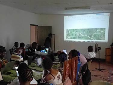
Turnout exceeded expectations, with 37 people: BCL interns, NGOs, BCL members, public-administration staff and researchers from the Institute of Agricultural Research for Development (IRAD).

Session in the IRAD conference room, Kribi. Source: Field Mapping BCL Training, Kribi, 2026.
OSM account creation. 22 OpenStreetMap accounts were created and activated — a first milestone towards a local community of contributors.
Mapathon — Cameroon–Nigeria project. In the afternoon, participants contributed to the Cameroon–Nigeria project via the HOT Tasking Manager, digitising buildings and roads from satellite imagery — tangible contributions from day one.
Day 1 results
Indicator | Result |
Participants mobilised | 37 (initial target: 25) |
OSM accounts created | 22 operational OpenStreetMap accounts |
Tools practised | JOSM · HOT Tasking Manager |
Project mapped | Cameroun–Nigeria (HOT Tasking Manager) |
Completion rate | 100% of the Day 1 programme |
Day 2 — Field mapping with ChatMap and uMap
The second day, which began at 08:40 with a presentation of BCL and its activities, was devoted to the hands-on use of collection and visualisation tools. The 27 participants were divided into 5 thematic groups related to Kribi’s urban living environment; each group appointed a group leader and created a dedicated WhatsApp group to coordinate collection beyond the workshop.
Thematic group formation
Group | Collection theme | Coordination channel |
Group 1 | Condition of drainage ditches | Dedicated WhatsApp group |
Group 2 | Water points | Dedicated WhatsApp group |
Group 3 | Public lighting | Dedicated WhatsApp group |
Group 4 | Waste dumps | Dedicated WhatsApp group |
Group 5 | Electricity poles | Dedicated WhatsApp group |
Field collection in Mokolo (ChatMap)
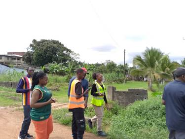
Following an introduction to ChatMap (principles of geospatial data collection, interface and form creation), the groups deployed to the field in the Mokolo neighbourhood of Kribi. Each group geolocated and documented the features of its theme via WhatsApp. The data were then compiled, cleaned and verified as a group.

Field data collection in Mokolo (Kribi) with ChatMap. Source: Field Mapping BCL Training, Kribi, 2026.
Visualisation and publishing (uMap)
The afternoon was devoted to uMap. Participants learned to create interactive maps, import their ChatMap data and style it (colours, legends, pop-ups). Each group finalised and published its map, then shared the generated uMap link.

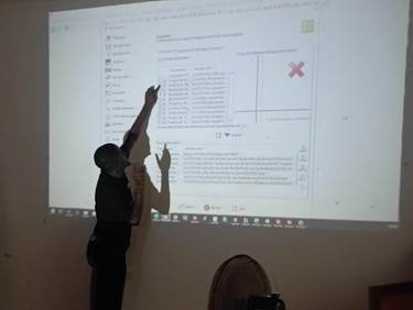
Getting started with Josm and mapping by the groups. Source: remote Mapping BCL Training, Kribi, 2026.
Deliverables — published interactive maps
Five interactive maps were produced and published, one per theme. Together with the ChatMap datasets, they constitute the tangible deliverables of the workshop.
Group 1 — Condition of drainage ditches

Published map: https://umap.hotosm.org/fr/map/chatmap_3755
Group 2 — Water points

Published map: https://umap.hotosm.org/fr/map/cartographie_pointdeau_kribimokolo_3766
Group 3 — Public lighting
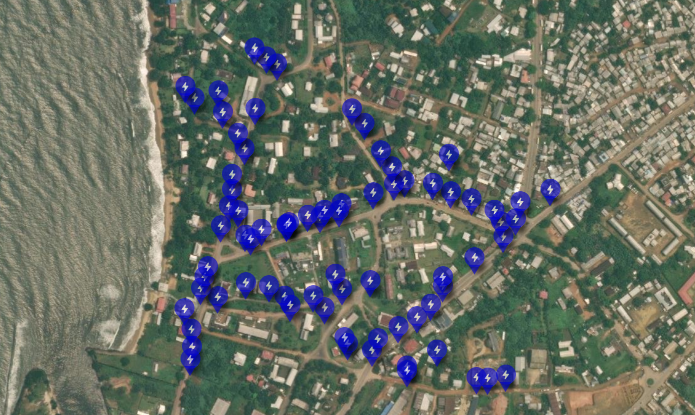
Published map: https://umap.hotosm.org/fr/map/cartographie_de-leclairage-publique_-kribi-quatier_3754#17/2.944085/9.907726
Group 4 — Waste dumps
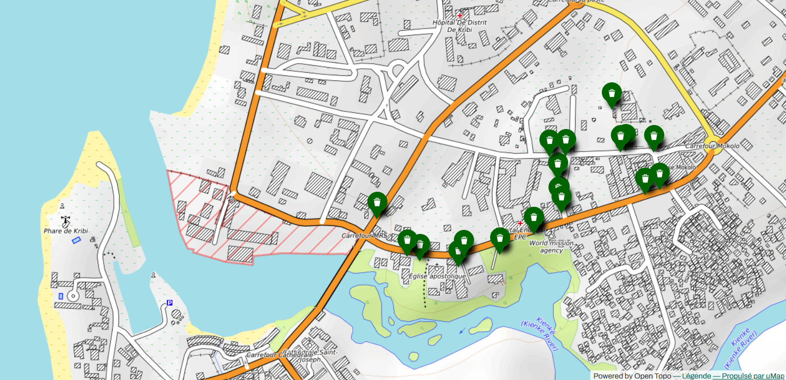
Published map: https://umap.hotosm.org/fr/map/cartographie_tas_dorduremokolo_3763
Group 5 — Electricity poles

Published map: https://umap.hotosm.org/fr/map/cartographie_des_poteaux_electriques_kribimokolo_3761
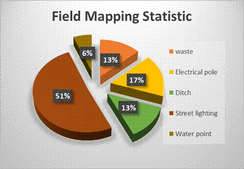
Day 2 results
Indicator | Result |
Participants mobilised | 27 |
Groups formed | 5 thematic groups (with group leaders) |
Themes covered | Drainage ditches, water points, public lighting, waste dumps, electricity poles |
WhatsApp groups created | 5 (one per theme) |
Tools practised | ChatMap (collection) · uMap (visualisation) |
Deliverables | ChatMap datasets · 5 published uMap interactive maps |
Lessons learned and recommendations
Strong turnout, combined with largely internal resources, highlighted several areas for improvement. They are summarised below, from observation to operational recommendation.
Area | Observation | Recommendation |
Communication | Invitations sent late and turnout hard to anticipate (37 present for 25 expected); a 27% drop in attendance between the two days. | Launch communications 3–4 weeks in advance, in several waves (announcement, D-7, D-1); set up formal registration with pre-selection. |
Logistics | Insufficient preparation for turnout above forecast; no dedicated logistics lead; equipment (computers, cables, power outlets, phones) in short supply. | Prepare a detailed logistics plan in advance, appoint a logistics lead distinct from the training coordinator, and size equipment to maximum turnout with a 20% margin. |
Catering and participant support | No support (meals, transport), penalising the most vulnerable participants and affecting attention and Day 2 attendance. | Include a catering budget (coffee break, lunch) and at least partial transport support to ensure equitable access and retention. |
Financial partners | Organised without dedicated external funding or local institutional partners, which constrained choices. | Approach financial partners 2–3 months in advance (concept note) and involve local authorities, technical services and the private sector as co-organisers. |
Technical aspects | Heterogeneous skill levels; limited internet connectivity (field and venue); field themes weakly linked to BCL’s biodiversity mission. | Assess levels beforehand and form homogeneous groups; test network coverage and plan offline solutions; add conservation themes (degraded areas, invasive species, pressures on coastal ecosystems). |
Overall assessment
Indicator | Result |
Total duration | 2 days (24–25 August 2026) |
Participants | Day 1: 37 · Day 2: 27 |
OSM accounts created | 22 operational accounts |
Working groups | 5 thematic groups |
WhatsApp groups | 5 (field follow-up) |
Themes mapped | Drainage ditches, water points, public lighting, waste dumps, electricity poles |
Tools covered | OSM · JOSM · HOT Tasking Manager · ChatMap · uMap |
Project contributed to | Cameroun–Nigeria (HOT Tasking Manager) |
Deliverables | ChatMap data · 5 published uMap maps |
Conclusion and outlook
The Kribi workshop, organised by BCL in partnership with UN Mappers on 24–25 August 2026, met its objectives. The strong turnout over both days reflects the genuine interest and need of local communities for participatory mapping tools.
The concrete results — 22 OSM accounts created, 5 thematic groups formed with their coordination channels, and field data collected and published as interactive maps — provide a solid basis for continuing open-mapping activities in Kribi and the South Region.
BCL and UN Mappers reaffirm their commitment to supporting this emerging momentum towards the establishment of a UN Mappers Chapter in Cameroon, in support of local development, biodiversity conservation and the humanitarian action of the United Nations.
Photo gallery
|
|
|
|
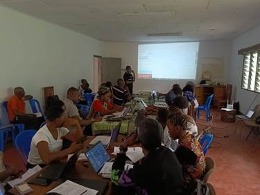
Group work, field collection and presentations. Source: Field and remote Mapping BCL Training, Kribi, 2026.
Full photo album: https://photos.app.goo.gl/JuAWsLyCn4uAiUU89